Diversion Spacing
How PlaneWX scans your route for runway-suitable diversion options and surfaces long gaps on the route map.
What Is Diversion Spacing?
Diversion spacing answers a practical question: along your planned route, how far are you from a runway that meets your aircraft's minimum requirements? PlaneWX samples the route corridor, estimates time to the nearest suitable airport at your cruise speed, and flags segments where that time is unusually long.
This is a structural route-planning check, not a weather score change. A long diversion gap does not automatically lower your WX Score, but it is worth knowing before you commit, especially on overwater, desert, or international segments where suitable fields are sparse.
How the Scan Works
Corridor width
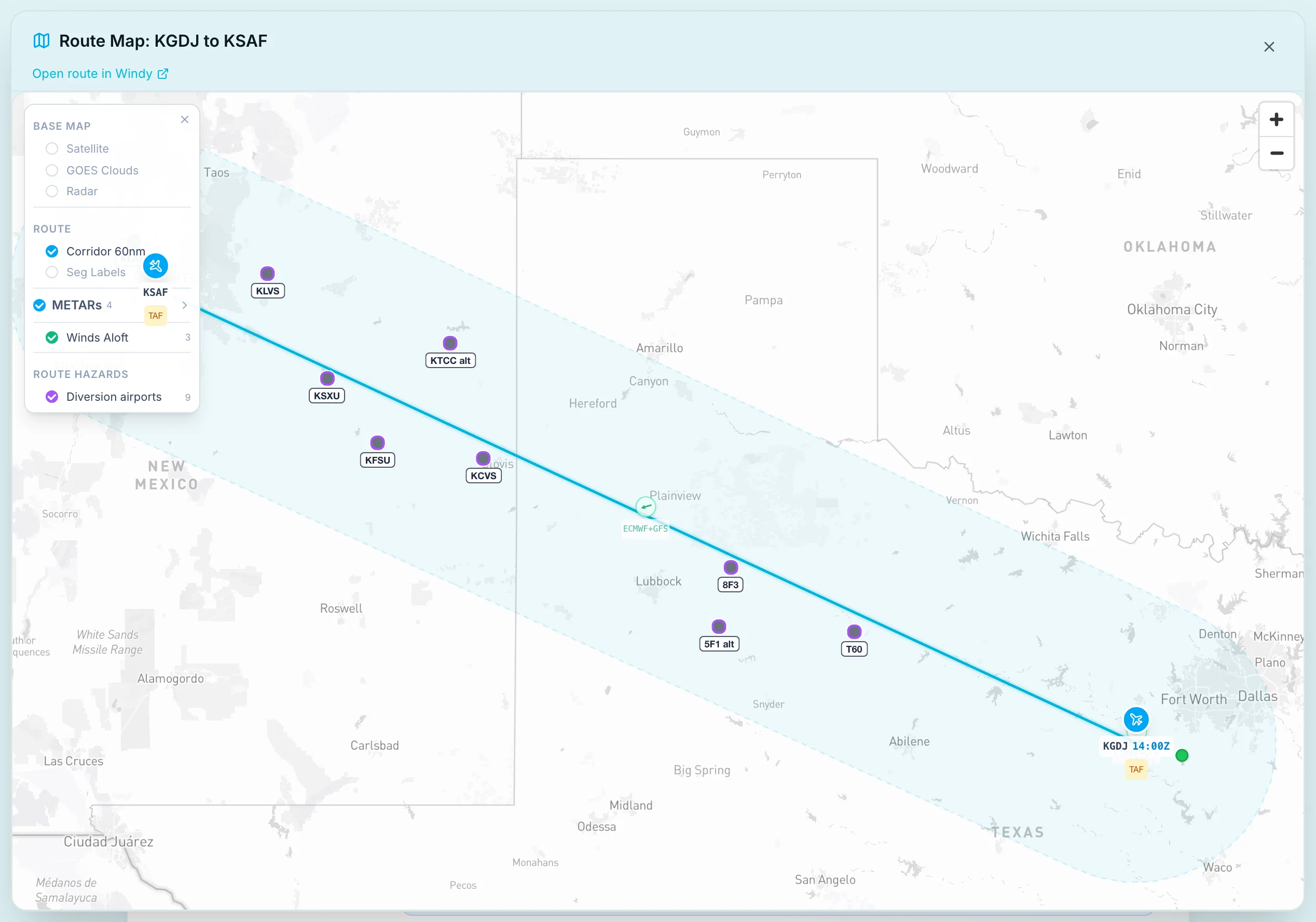
When diversion analysis completes, airports within 60 NM of your route polyline are considered and the map draws that same 60 NM corridor. If diversion analysis is unavailable, the map falls back to the METAR corridor width for that route (distance and speed based), which may not be 60 NM. The scan uses your aircraft profile: minimum runway length and paved-only setting when configured.
Sampling
The route is sampled every 10 NM. At each point, PlaneWX finds the nearest runway-suitable airport in the corridor and converts distance to minutes at your planned ground speed.
Gap thresholds
- Gap spike (20 min or more): Contiguous segments where time to the nearest suitable runway is 20 minutes or more. Shown as purple hazard lines on the route map.
- Elevated (8 min or more): No full spike, but max time to nearest is 8 minutes or more; may trigger a briefing callout.
Domestic US routes
When both ends of the trip are US airports (K or P identifiers), PlaneWX prefers US fields in the corridor. Neighboring Canadian and Mexican airports are still scanned; they are used only when no US airport exists anywhere in the 60 NM corridor, and then labeled with the exact customs note: "Canada: customs and eAPIS required", "Mexico: customs and eAPIS required" (MM identifiers only), or "Outside the US: customs required" for other foreign prefixes (for example MY Bahamas). Exception: Lower 48 (K) to Alaska (PA/PF/PO/PP) routes that cross Canada keep Canadian corridor fields so gap minutes are not inflated. Puerto Rico (TJ) and other non-K/P Caribbean identifiers are treated as international corridors for this scan.
Route Map Layers
In Enhanced briefing view, open the route map and use the layer toggles:
Diversion gaps
Purple segments along the route where spacing exceeds the gap spike threshold. Click a segment for distance along route, span length, and peak minutes to nearest suitable runway.
Diversion airports
Violet markers for the nearest suitable airport at each sample where time to nearest is 8 minutes or more. The violet banner under the route map reports the max minutes and the corridor count. The Diversion spacing line in the briefing text can name the nearest suitable airport at the longest gap, for example (KLVS). A second pin may mark a practical alternate when it is within about 5 minutes of that nearest field and still inside the diversion corridor. The alternate never replaces the nearest pin.
The banner count, map pins, max minutes figure, and AI diversion text all come from this one corridor list so the numbers stay consistent across the diversion section. Pins mark the nearest suitable airport at each point where the nearest suitable airport is 8 or more minutes away; a second pin may mark a practical alternate within 5 minutes of that nearest field. Map, prompt and audit list share the same capped set of pins.
Briefing Callout
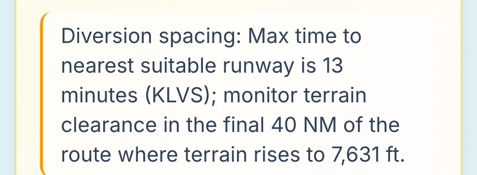
When spacing is structurally noteworthy (gap spikes, elevated max spacing, or no suitable airports in the corridor), a callout appears in your Enhanced briefing. It reports how many suitable airports are in the diversion corridor (60 NM when analysis completed). When pins are present, it notes that they mark the nearest airport at each point where the nearest suitable airport is 8 or more minutes away (with an optional practical alternate pin within 5 minutes). The AI may also mention diversion spacing in the En Route or Gotchas sections using the same server-computed facts.
When that briefing text states the max time to the nearest suitable runway, it uses the same rounded minutes as the banner. When the analysis identifies the nearest suitable airport at the longest gap, the line names it, either in parentheses (for example, "Max time to nearest suitable runway is 13 minutes (KLVS)") or in a following sentence: "The nearest suitable airport at the longest gap is KLVS."
If convective or other hazardous weather overlaps a gap segment, shadow scoring may increase workload outlook and cap combined risk when weather and sparse divert options align, reducing contingency margin.

What v1 Does Not Include
- •Fuel or endurance: spacing is time-to-runway, not whether you can reach an alternate on remaining fuel
- •Full customs planning: on domestic US routes a foreign pin (only when no US field exists anywhere in the corridor, except Lower 48 to Alaska PA/PF/PO/PP routes that keep Canadian fields) carries a customs label; broader entry and clearance planning is still your call
- •Additional METAR fetches for diversion markers: shows cached METAR when available, but does not fetch new weather data specifically for diversion airports; full alternate weather is separate from the marker cache
- •Services or lighting: no FBO, fuel, or night-ops filtering beyond runway length and surface type
Important Notes
- Database coverage varies. Remote strips and some international fields may be missing or misclassified. Always cross-check with current charts and NOTAMs.
- Small ICAO codes are real. Codes like MM50 in Mexico are valid OurAirports identifiers for small strips. On international routes PlaneWX always pins the nearest suitable field and may add a larger practical alternate nearby when it is within about 5 minutes of that nearest field.
- Dense domestic routes often show nothing. A short hop over populated terrain with many suitable airports (e.g. 66TE to KVBT) typically has no gap spikes. That is expected.
- Planning aid only. Diversion spacing supports situational awareness; your PIC divert decision still depends on weather, fuel, aircraft state, and ATC.